Browse Items (2049 total)
Sort by:
Brodhead Historical Society 50th Anniversary

Some of the founders of the Brodhead Historical Society at the 50th anniversary celebration. L-R Frank Gombar, Carol Gombar, Clinton Bailey, and Polly Weeden. In back John Bernstein.
Brodhead Historical Society 50th Anniversary Celebration

The Brodhead Historical Society celebrated it's 50th anniversary at a regular meeting in the summer of 2025. Since the society was founded in the 1970's attendees were encouraged to wear 70's attire. L-R Clinton Bailey, Polly Weeden, Ann Schwartz,…
Brodhead Farmers Night Invitation

In the late 1940's and early 1950's the Brodhead Business Men sponsored a "farmers night". Shown is the 1948 invitation. The pencil marks are changes to be made for the 1950 invitation. The entertainment was well known national performers.. The…
Brodhead, Wisconsin Street Scene.

A post card with a Brodhead, Wisconsin street scene.
Clarence Covered Bridge

Post card of the Clarence Covered Bridge south of Brodhead, Wisconsin. It spanned the Sugar River on at that time Route 20. The road now is Hwy 11-81.
Clarence Covered Bridge

The Clarence Covered Bridge 2 miles southwest of Brodhead, Wisconsin. The bridge got its' name from a small village that was once a quarter mile to the east. The village was settled in 1841. Before a bridge was built Jacob TenEyck, the closest land…
Clarence Covered Bridge

Auto exiting the Clarence Covered Bridge. See #3290 for details.
Clarence Covered Bridge

A man and two children in front of the Clarence Covered Bridge. See #3290 for details.
Bluff View Park

Entrance gate to Bluff View Amusement Park. The park was along the Sugar River 2 miles southwest of Brodhead Wisconsin on Highway 11; highway 20 at the time of the photo. Notice the Clarence Covered Bridge in the right background.
Family Photograph Along the Sugar River

Photograph of a family gathering along the west side of the Sugar River near Brodhead, Wisconsin. Note the Clarence Covered Bridge in the background.
Closed Clarence Covered Bridge

Photograph of the Clarence Covered Bridge. At the time of the photo the bridge was boarded closed after a heavy truck broke through the floor of the bridge.
Clarence Covered Bridge

The inside structure of the Clarence Covered Bridge near Brodhead, Wisconsin.
Hanging Rock - Pine Bluff
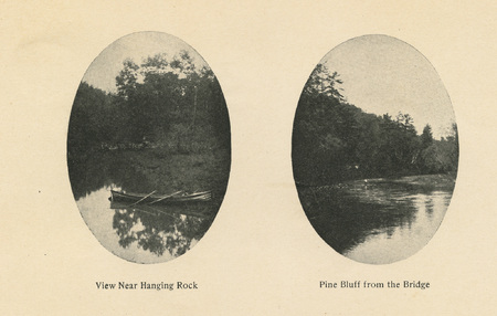
Dual photos. The one on the left is" Hanging Rock" on Searles Creek. Searles Creek runs from Sylvester Township into Decatur Township and empties into Decatur Lake and then the Sugar River. The one on the right is Pine Bluff taken from Clarnce Bridge…
The Sugar River

The Sugar River, Brodhead Wisconsin.
Couple in Horse Drawn Carriage

An unknown man and woman in a horse drawn carriage.
Farm Scene

Unidentified people in a farm scene.
Farm Scene
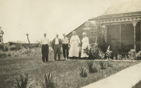
Group of people at "Pleasant View Farm".
Group Photo

Unknown group of people at "Pleasant View Farm".
Travelers At Clarence Covered Bridge
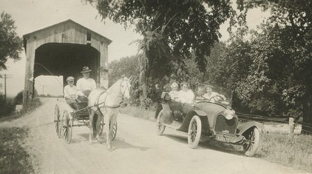
Travelers at the west end of Clarence Covered Bridge.